check hello
check ef
sd
fsd
fads
check hello
check ef
sd
fsd
fads
|
 |
ויזלאב זמין לשימוש למשתמשים בתוך הטכניון ומחוצה לו. המעבדה מאפשרת מגוון רחב של שימושים כגון:
משתמשי ויזלאב יקבלו תמיכה של סטודנטים מוסמכים בהכנת הקבצים עד לשימוש המלא במעבדה.
ראשון, שני, חמישי 9:00 – 13:00
מועדים נוספים ניתן לתאם מראש.
השימוש בויזלאב חופשי לחברי סגל וסטודנטים בפקולטה לאדריכלות. משתמשים נוספים מוזמנים להשתמש במעבדה בתשלום סמלי של:
על מנת לתאם שימוש במעבדה או תצוגת תכלית (ללא עלות), צרו קשר עם מנהלת המעבדה מירב אהרון.
MSc Thesis by Michal Gath Morad, Advisers: Yehuda E. Kalay, Pnina Plaut
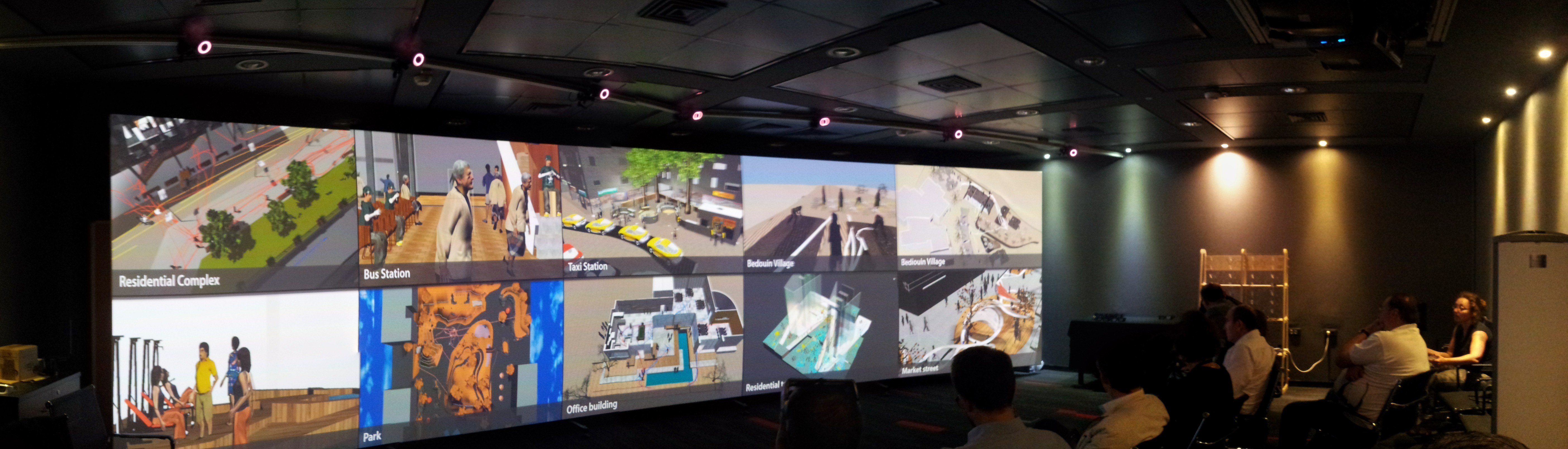
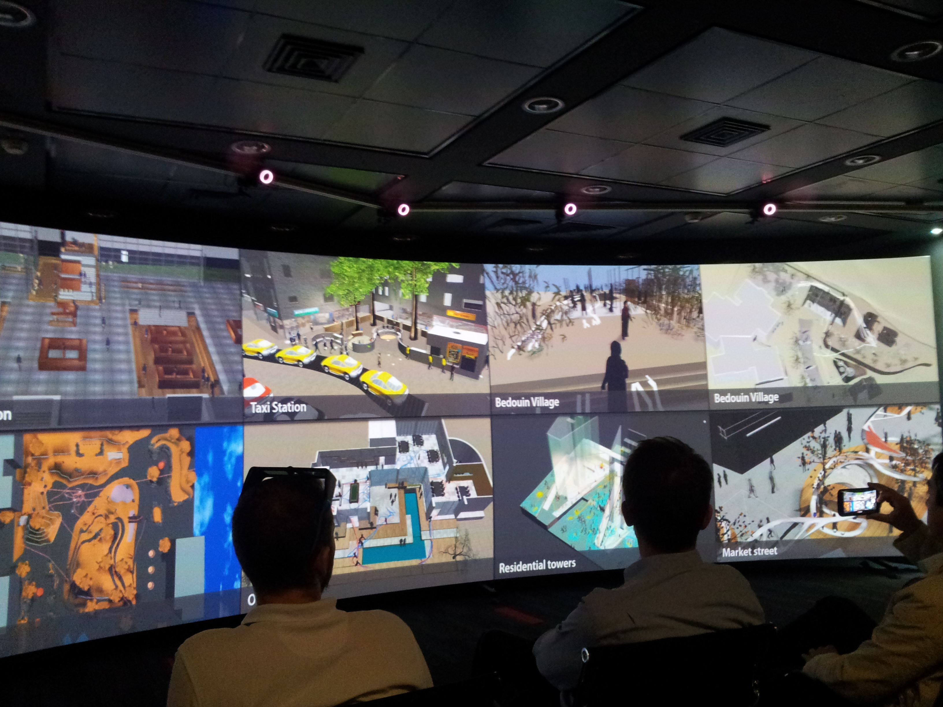
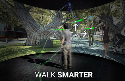 The project is part of a MSc thesis by Michal Gath Morad. The thesis project provides an empirical exploration of “smart cities” from a human, technological and spatial perspective. The main question which underlies the research is how can we tell if Information and Communication Technologies (ICT) could make cities “smarter”? And if yes, what would be the tradeoffs of such urban “smartness”? Unlike past technologies used by cities as part of a strategic plan, carefully devised by planners and experts, today’s most powerful technology —ICT—is used and owned by everyone: planners and citizens alike. A multitude of applications at citizens’ disposal help them process information in real time and empowers them with new decision-making capabilities, which enable them to act according to their individual goals as they gain what I term ”artificial spatial intelligence”. Current research in this field fails to account for the human and spatial factor in “smart cities” and evaluation tools that can help planners evaluate and design truly “smart cities” are limited. To mitigate this gap, a virtual smart city simulation is developed, in which objects (obstacles, people, cyclists, buses, Points of Interest) locations and status is being recorded in real time. The information feed is then processed and delivered to pedestrians, filtered by their personal preferences. To test the effect of this so called “smart city” on pedestrian behavior, the visualisation lab is used to conduct experiments in which real human pedestrians interact with the smart city simulation in a virtual reality setting. The experiment results are still being processed but it’s evident that ICT played a significant role in pedestrian’s decision making process, which in turn transformed the way they walked and “used” the city. The ability to simulate individual pedestrians behavior and how it is affected by enhanced spatial awareness facilitated by ICT, could result in new understanding of how a city is used, making visible less predictable use patterns and contribute to the design of truly smart and livable cities.
Dr. Hagit Zimroni, Dr. Daniel Orenstein, Dr. Efrat Eizenberg.
We utilize VizLab to study stakeholder perceptions of landscapes and their associated cultural ecosystem services in Israel’s Carmel Forest. Visualization has become a ubiquitous method in land use planning to actively engage stakeholders in decision making. In our research, funded by the Israel Ministry of Environmental Protection, the subject (stakeholder) is exposed to a diversity of actual and hypothetical landscapes where they can experience and evaluate multiple land use alternatives. We project various high definition photographs reflecting current status of the forest and future scenarios of forest management (e.g. density and species of trees, presence/absence of buffer zones) as a trigger for focused group discussions regarding aesthetic and ecological issues in the forest.
Contact: Dr. Hagit Zimroni.
Dr. Michelle Portman, Dr. Daniel Orenstein, Dr. Tally Katz-Gerro (Haifa University), and Mr. Semion Polinov.
We are developing methodologies for identifying, quantifying and analyzing ecosystem services (ES) on land and sea. The case study for our multidisciplinary assessment is a land-sea transect starting on Mt. Carmel and continuing and including the Mediterranean Sea (to the outer limit of Israel’s territorial sea, c. 22 km from the shoreline). Our methodology includes: 1) selection of indicators for valuing ecological, economic and social aspects of ES, 2) developing a GIS-based method for defining the spatial dimensions of ES, and 3) applying the method to policy-making for spatial planning and natural resource management. The Vizlab helps us to perform quality control of services indicators (e.g. visibility of landscape from given geographic points) and to get a better view and understanding of the complexity of the different landscape units as they change spatially and temporally. By using 3D imaging we can improve our understanding about the correlation between visibility from a given point and its aesthetic value as well as view the extent of the transect as a continuous unit from multiple perspective (e.g., flyover view of bathymetry).
Contact: Dr. Michelle Portman.
PhD Candidate Arch. Asya Natapov, Prof. Daniel Czamanski, Dr. Dafna Fisher-Gewirtzman.
This project is part of the PhD research of Asya Natapov. It utilizes VizLab to investigate human navigation in urban environment. In particular, we are interested in the interaction of urban functional structure and human cognitive capabilities, such as vision. We explore the distribution of one particular urban function – cafés, coffee shops, restaurants and other food and drink facilities and investigate their visibility within urban setting of the historical district of Tel Aviv-Yafo, called Lev Hair (City Center). Immersive virtual reality platform of the VizLab allows performing navigational tasks in more controlled way, than in real urban environments. Thus, we construct a three dimensional model of the case study and carry out walk-through experiments in order to investigate human navigational strategies, route choices and decision making processes. During the experiments participants’ trajectories and destination points are tracked. This information is expected to give insights about human perception and navigation in urban space and will be compared with spatial analysis data developed on the previous stages of the research.
Contact: Asya Natapov.
Dr. Dafna Fisher-Gewirtzman.
The objective of this research was to develop an integrated analysis and modeling for environmental systems referring to interior space layout and functionality: integrating advanced Spatial Openness Index within realistic geovisualized Geographical Information (GIS) environment and assessment against subjective residents evaluation. In this stage of the research two attempts to develop an elaborated 3D visibility analysis were made. The next step for both models development is considering attributes of the environments, that is to say, the quality of visible space in addition to quantity; establishing an elaborated 3D visibility analysis with a GIS environment. A wide-scale assessment to the voxel based 3D visual analysis have been completed. The results have shown very strong tendency and high correlation between perceived density and the measured volume of space.
Contact: Dafna Fisher-Gewirtzman.
Graduate student Avishag Shemesh, Dr. Yasha (Jacob) Grobman, Professor Moshe Bar (Bar Ilan University).
This research will aspire to develop and evaluate research methods and tools that examine the connection between geometry of space, visual perception and emotions. Using the Visualization lab in the architecture faculty, which contains 3-D visualization capacity and motion sensors, Participants will be experiencing an inner virtual space, while their brain response and physiological response will be observed. This observation will be possible through the use of advanced handled devices such as EEG and GSR, which will be attached to the participant as he moves freely through the virtual space.
Contact: Avishag Shemesh.
|
|
Visuospatial search in urban environment simulated by random walks
|
|
|
|
Perception of density by pedestrians on urban paths: an experiment in virtual reality
|
|
|
|
Human behavior simulation in architectural design projects: An observational study in an academic course
|
|
|
|
CAN 3D VISIBILITY CALCULATIONS ALONG A PATH PREDICT THE PERCEIVED DENSITY OF PARTICIPANTS IMMERSED IN A VIRTUAL REALITY ENVIRONMENT?Dafna Fisher-Gewirtzman |
|
|
|
Why Immersive? Using an Immersive Virtual Environment in Architectural EducationHadas Sopher, Yehuda E. Kalay, Dafna Fisher-Gewirtzman
|
|
|
|
The association between perceived density in minimum apartments and spatial openness index three-dimensional visual analysisDafna Fisher-Gewirtzman
|
|
|
|
Integrating ‘weighted views’ to quantitative 3D visibility analysis as a predictive tool for perception of spaceDafna Fisher-Gewirtzman |
|
|
|
To go where no man has gone before: Virtual reality in architecture, landscape architecture and environmental planningMichelle .E.Portman, A.Natapov, D.Fisher-Gewirtzman
|
|
|
|
Visibility of urban activities and pedestrian routes: An experiment in a virtual environmentEfrat Eizenberg, Daniel E. Orenstein, Hagit Zimroni
|
|
|
|
Visualization for planning and management of oceans and coasts
|
|
|
|
Back to the (Visualization) Laboratory – Using Focus
|
|
|
|
Affective response to architecture – investigating human reaction to spaces with different geometry:Avishag Shemesh, Ronen Talmon, Ofer Karp, Idan Amir, Moshe Bar & Yasha Jacob Grobman
Abstract: A multidisciplinary research was carried out to reach an improved understanding of the connection between the geometry of space and human emotions. The research develops a framework and methodology to empirically examine and measure human reaction to various types of architectural space geometries. It involves two stages of investigations in which participants experience four spaces characterized by different geometries. Their reaction to the spaces was investigated by means of both qualitative and quantitative methods, which involved questionnaires in the first experiment and advanced sensors and data analysis in a second experiment. The experiments, which employ new virtual reality, electroencephalogram and data analysis methods, confirm the developed methodology. In the first stage of the investigation, participants showed different types of responses and preferences towards spaces. Results of the second stage’s experiment showed a difference in our mental reaction to different geometries of space. |
|
|
|
The immersive visualization theater: A new tool for ecosystem assessment and landscape planning:Daniel E. Orenstein, Hagit Zimroni, Efrat Eizenberg |
מיקום
סגל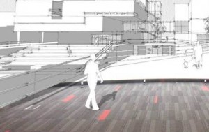
מנהלים אקדמיים קודמים
ועדה אקדמית
[pb_slideshow group=”1″]
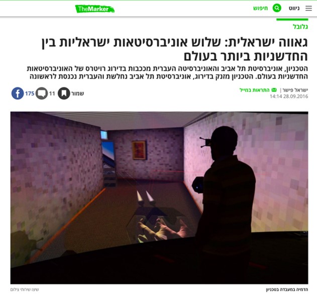
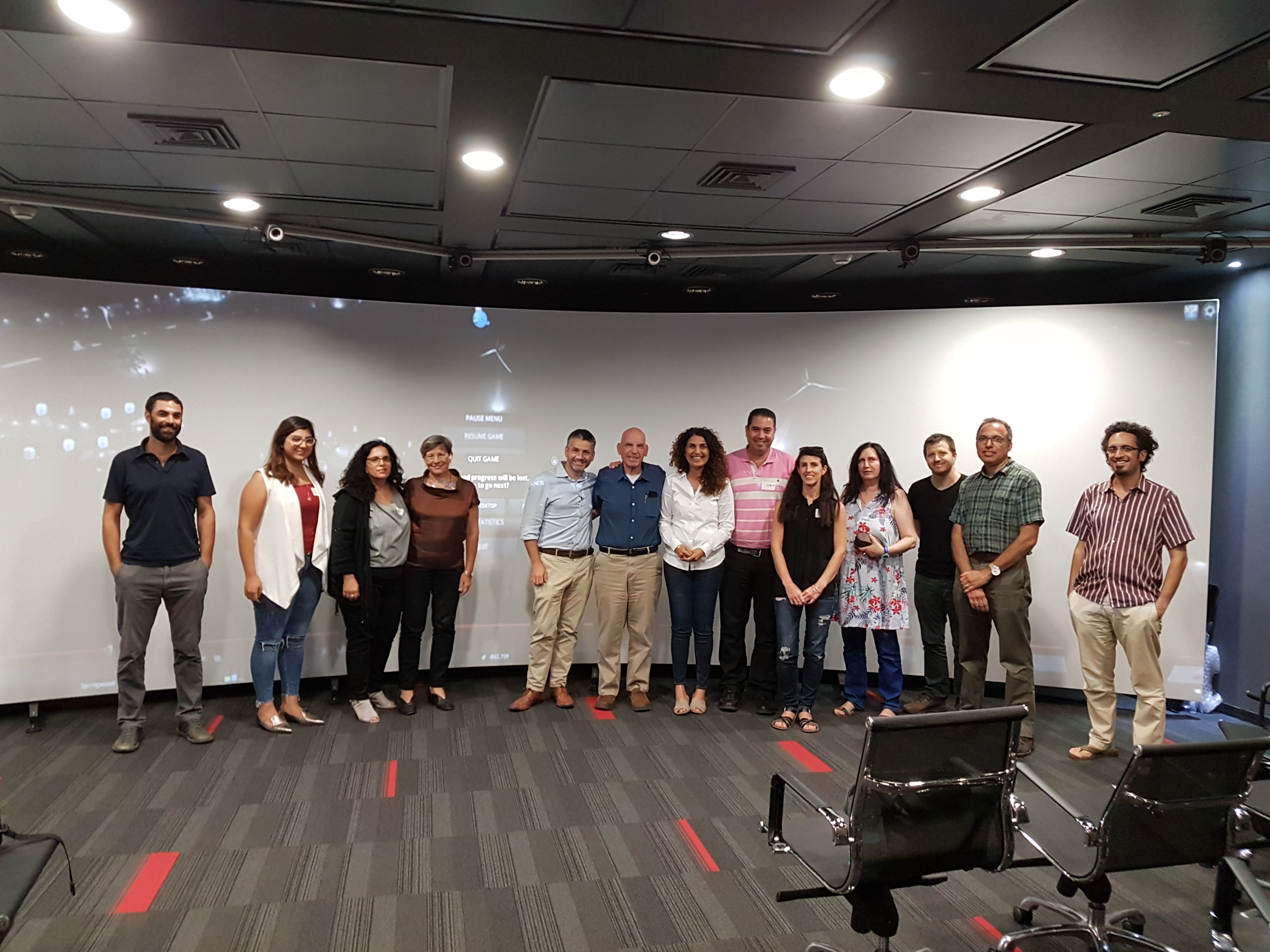
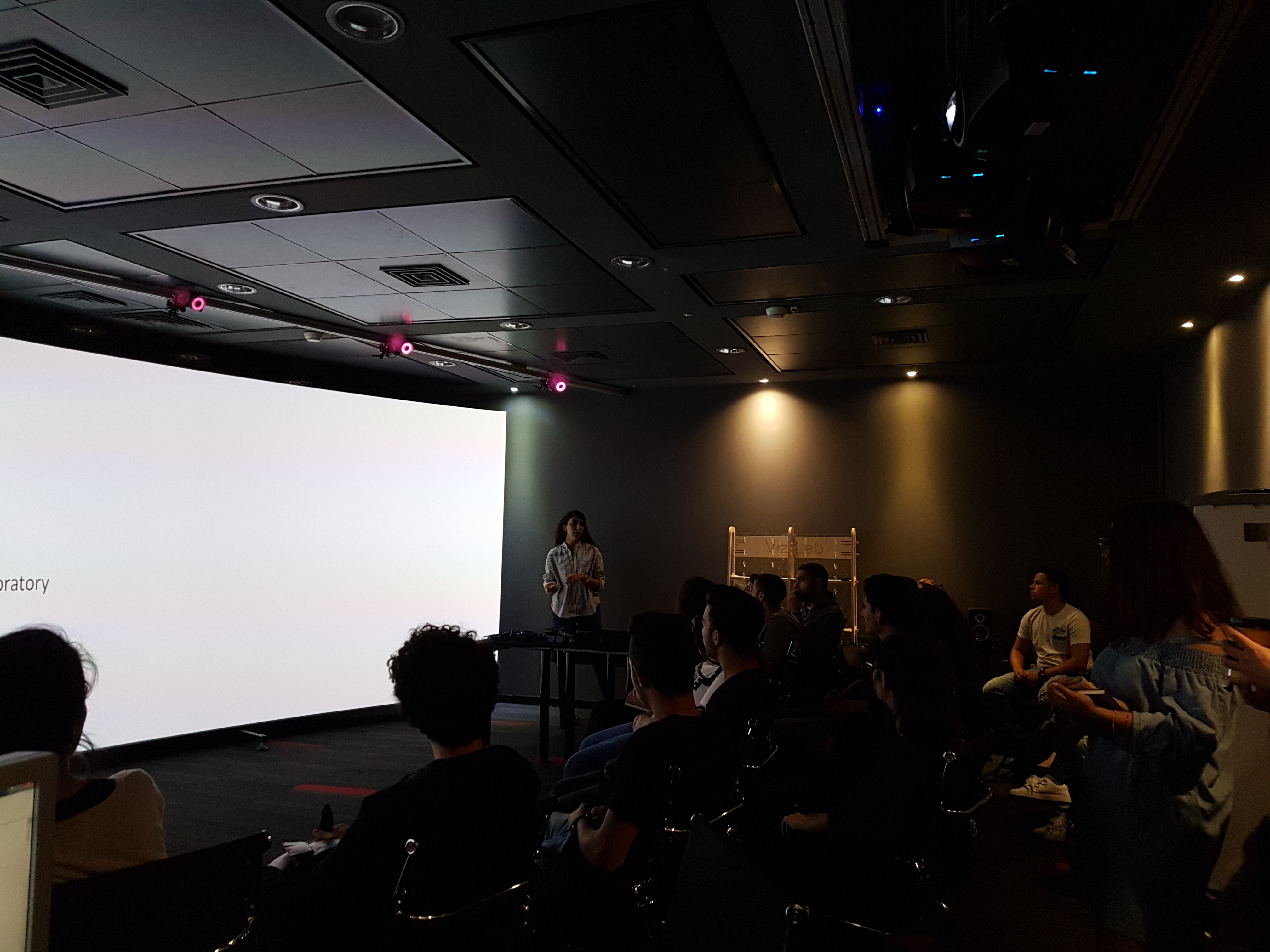
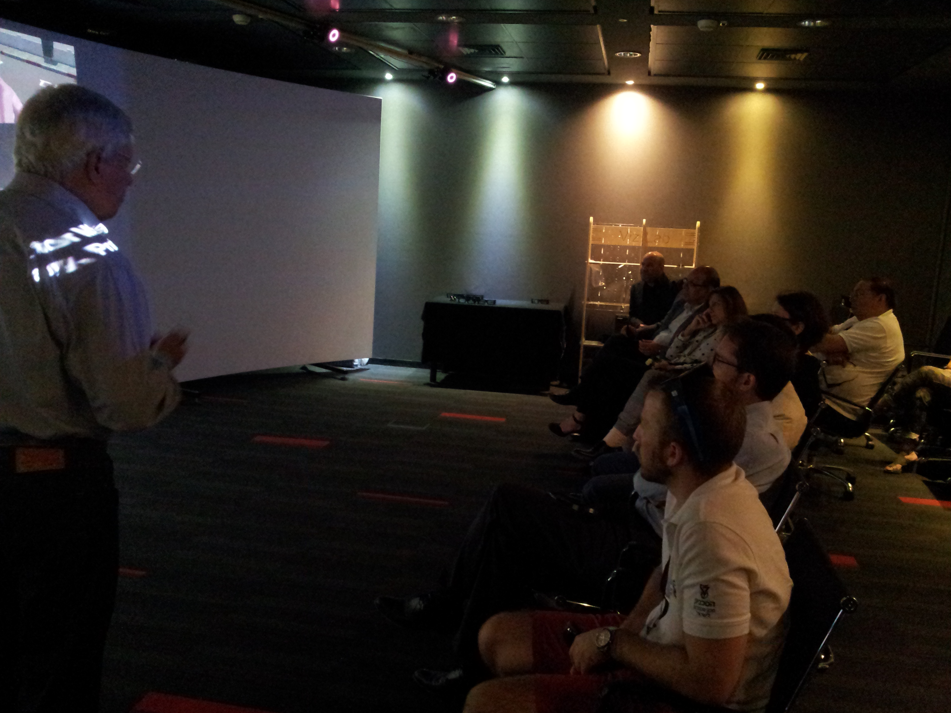
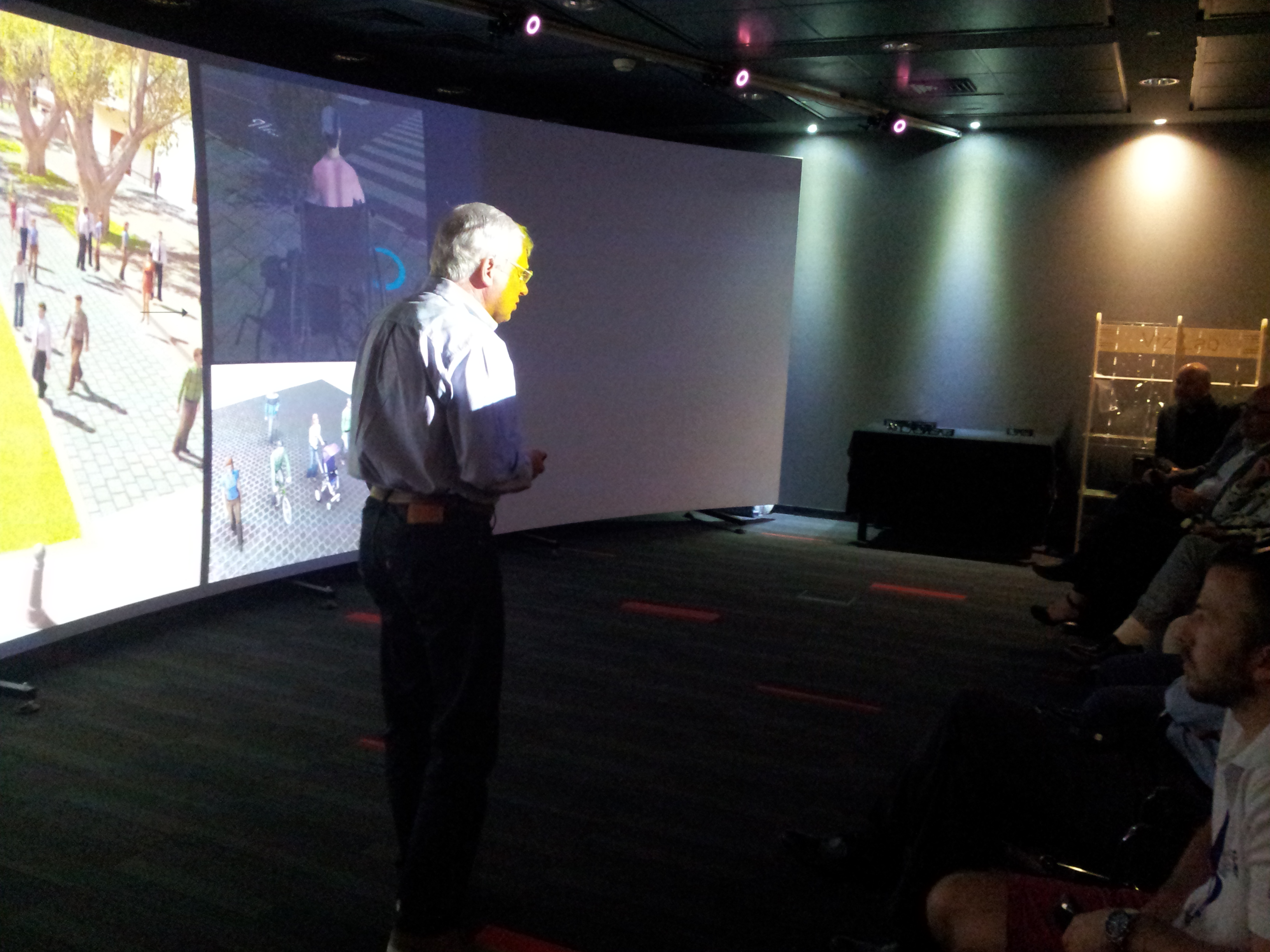
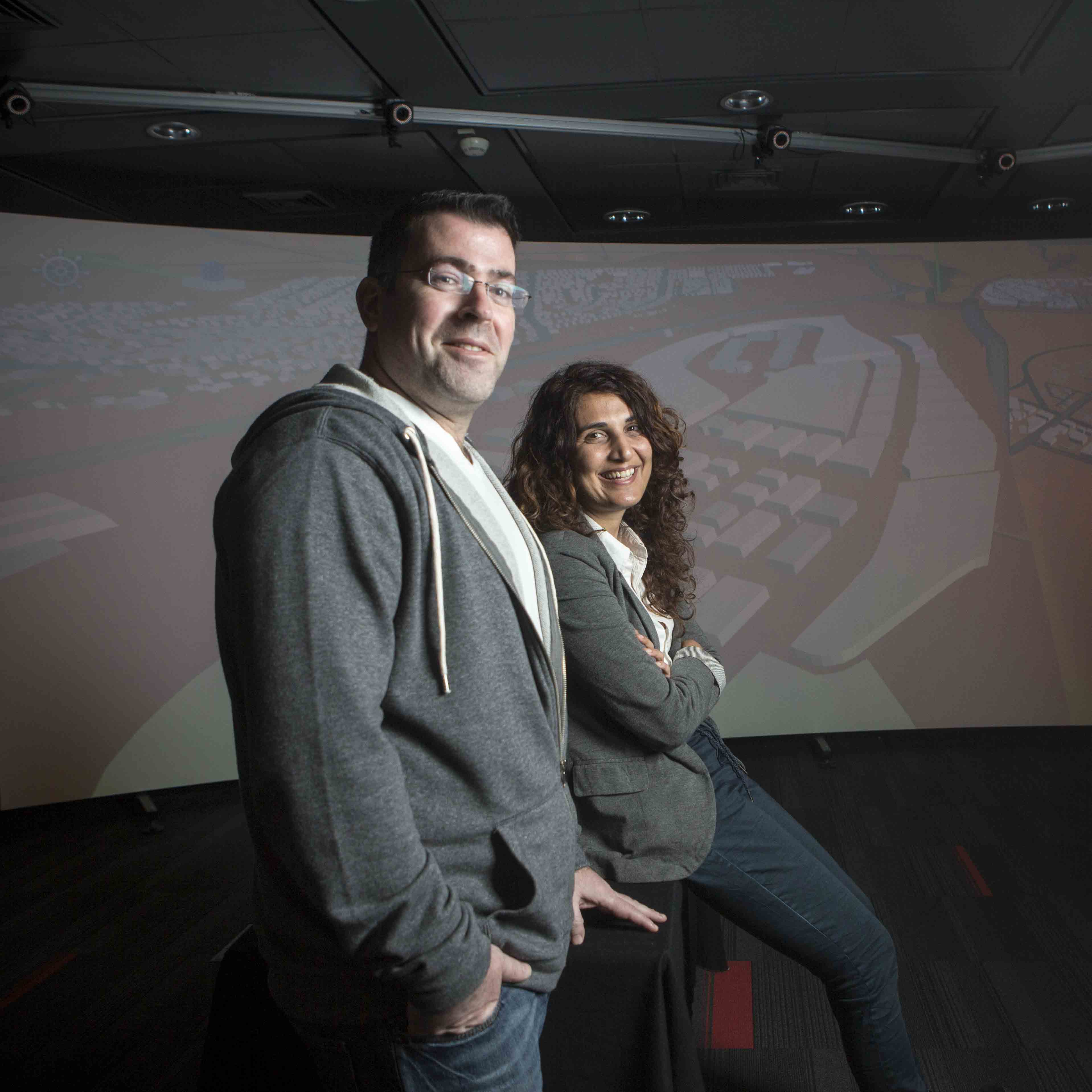
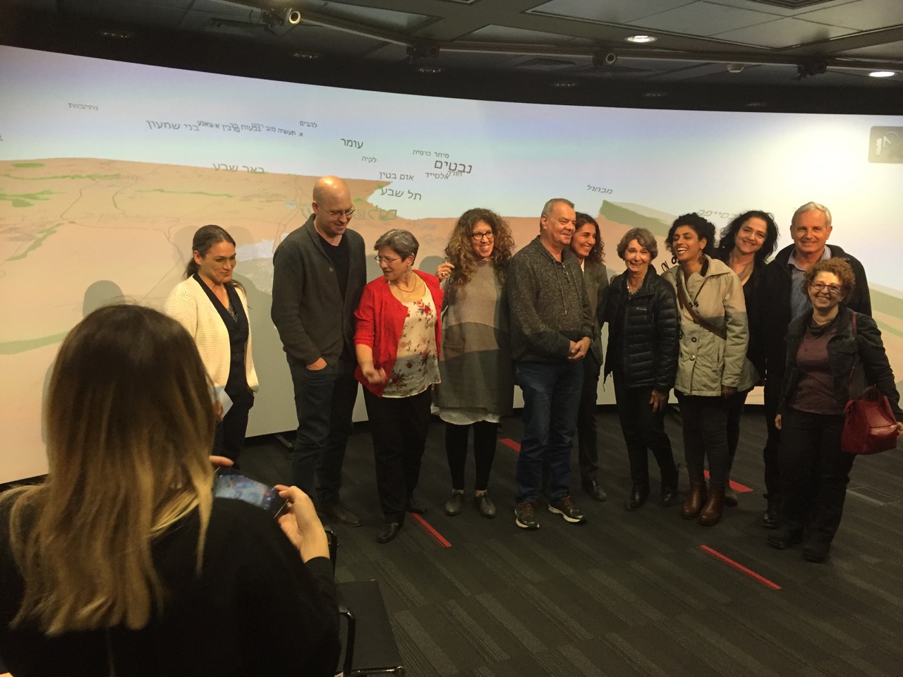
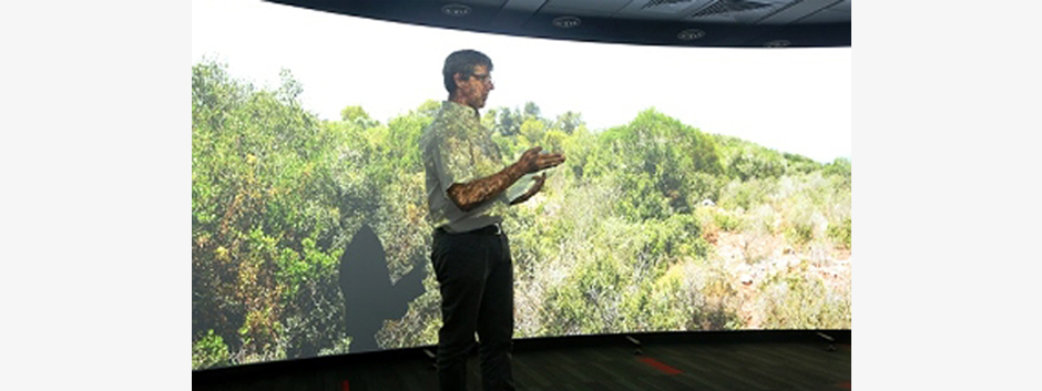
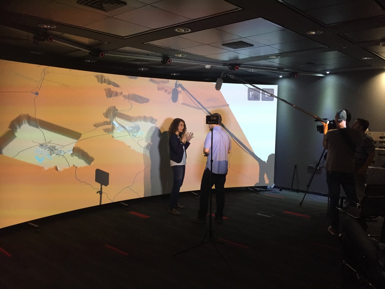
ויזלאב הוקם בחורף 2013 כחלק ממאמץ משותף של מספר חברים בפקולטה לאדריכלות בטכניון.
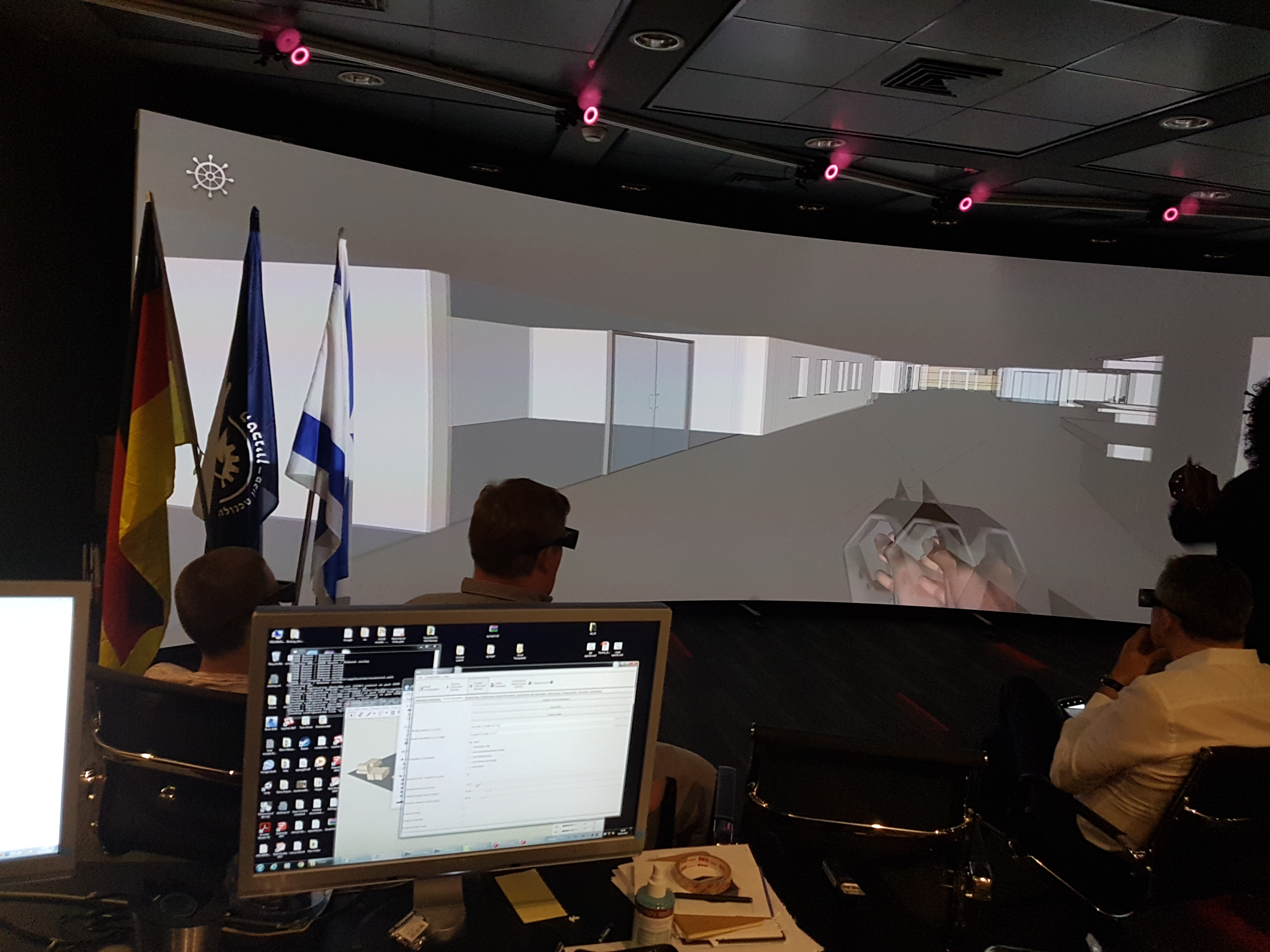
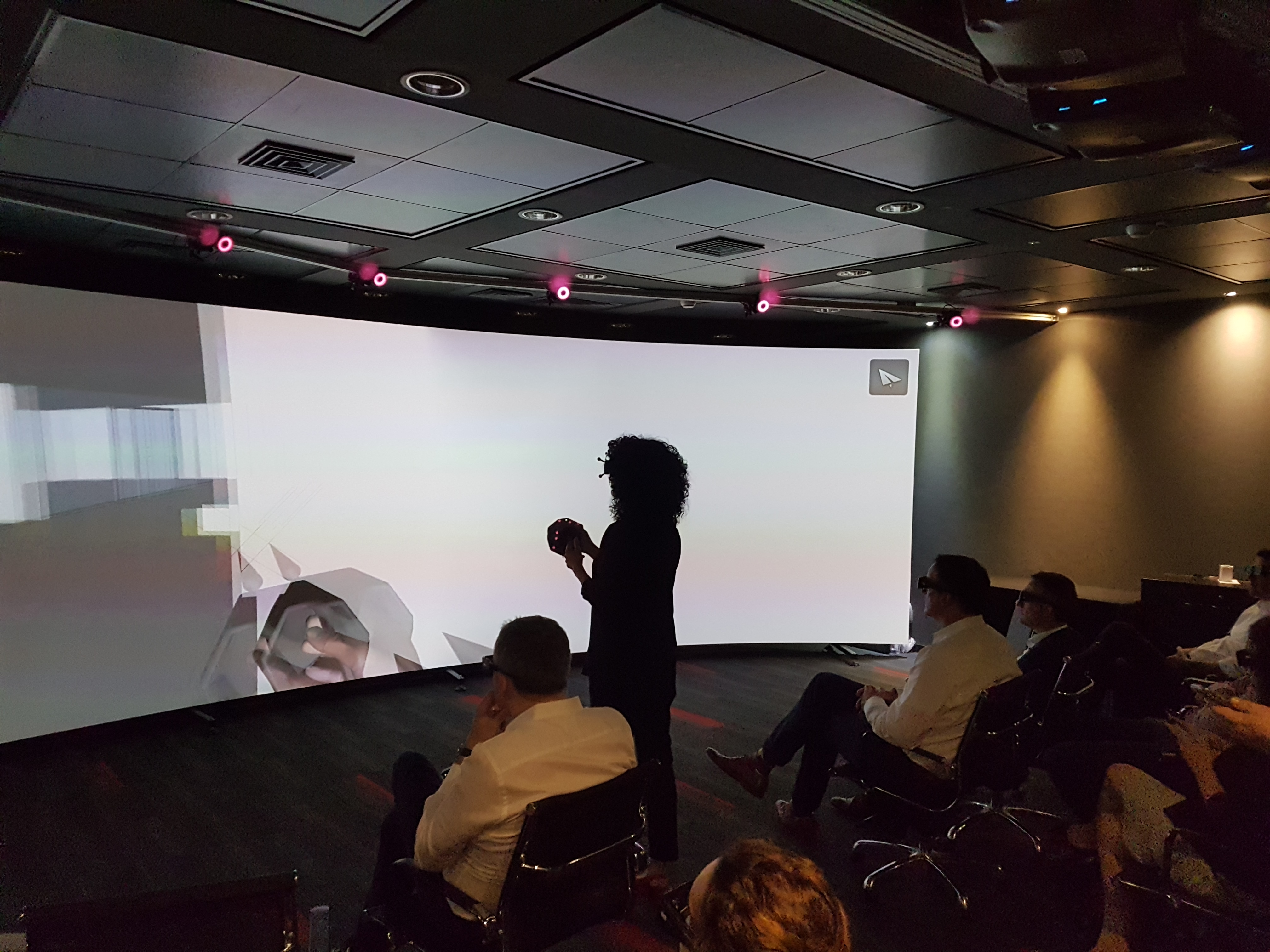
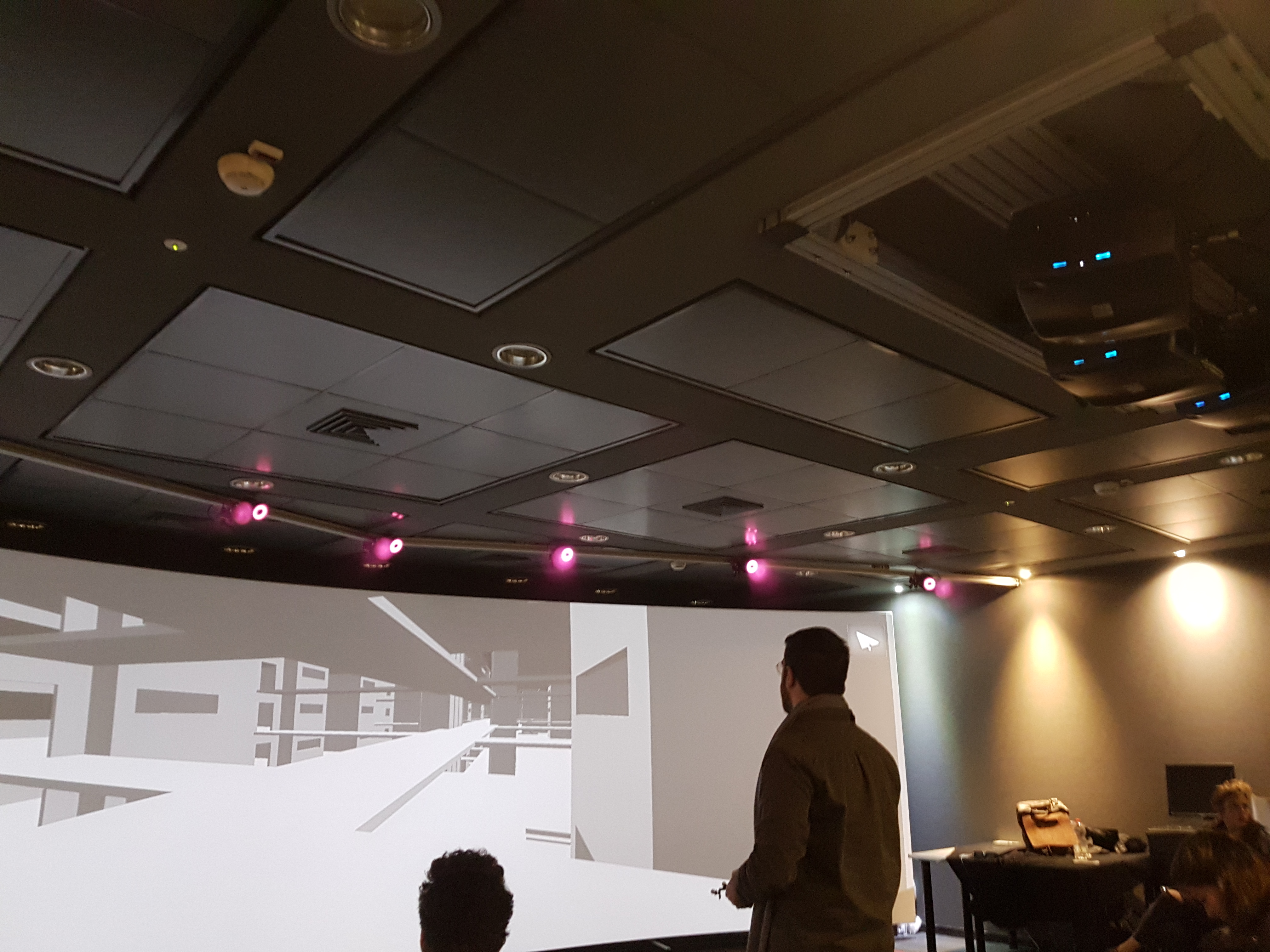
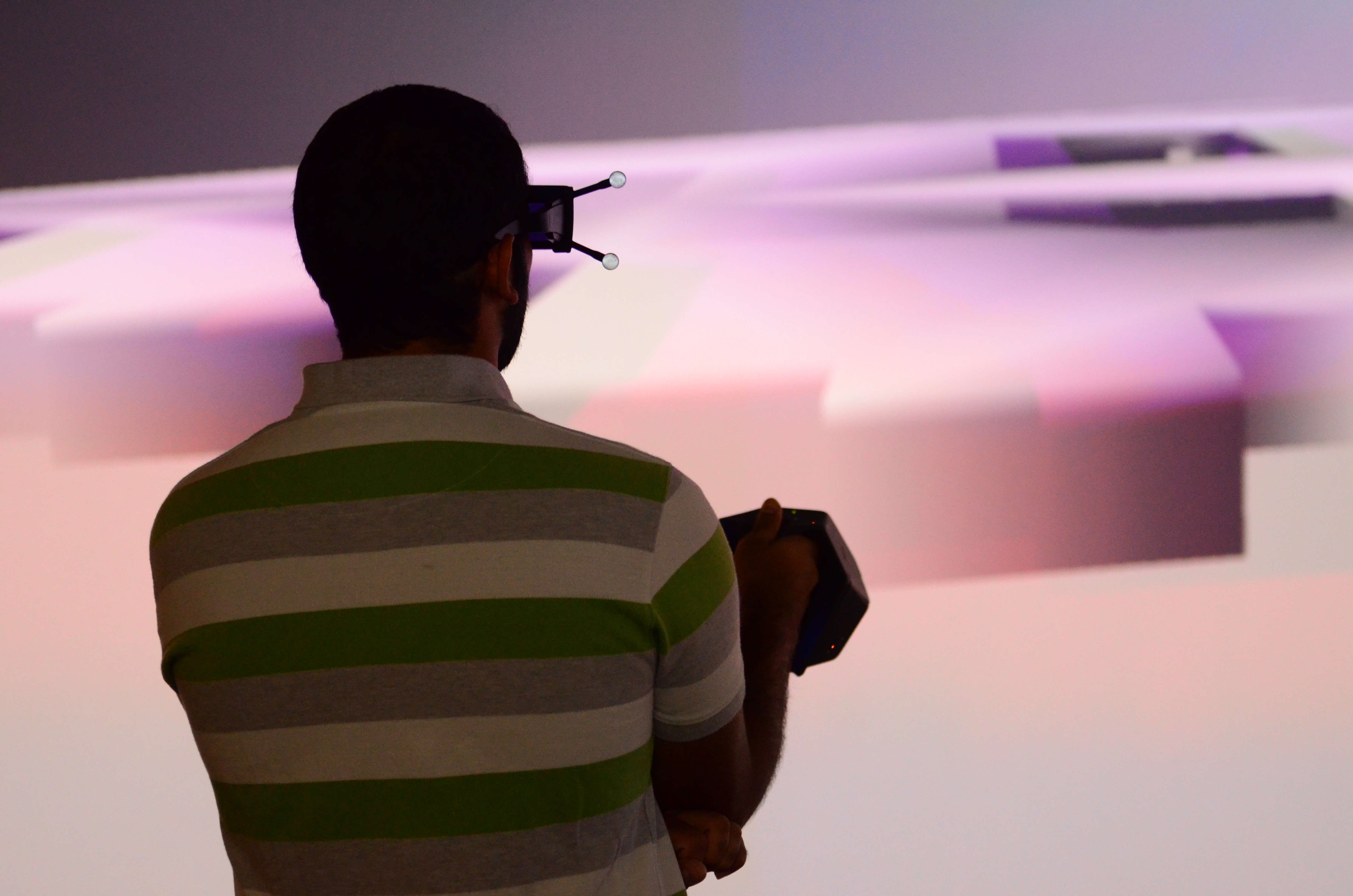
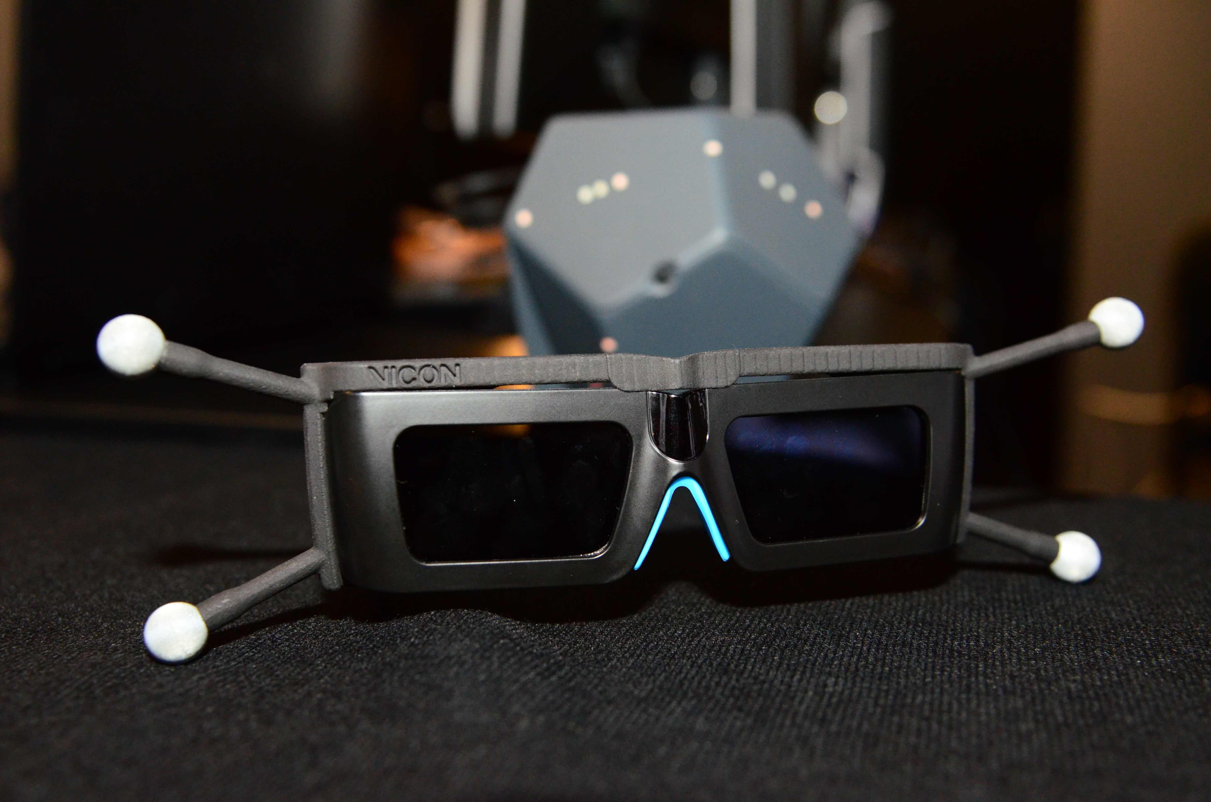
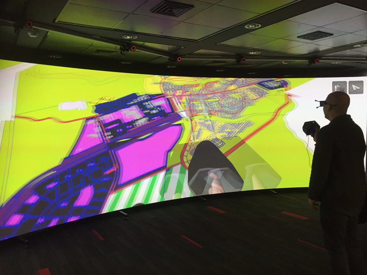
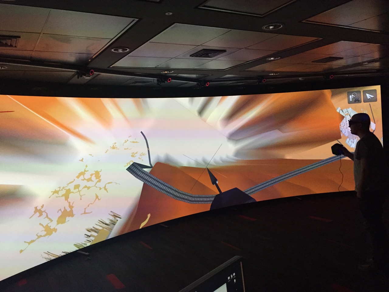
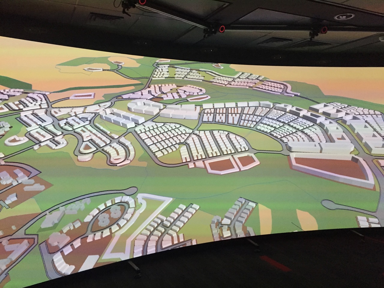
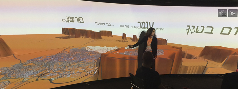
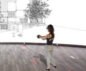
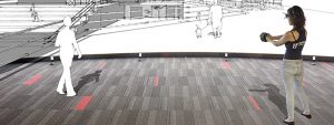
האלמנט המרכזי במעבדה הינו מסך תלת מימדי בגודל 7מ’ * 2.4מ’ המאפשר שדה ראייה של 75° ושלושה מקרני HD מסוג Projectiondesign® projectors.
המעבדה תוכננה והותקנה על ידיי Antycip Simulation®.
המעבדה תוכננה על ידי Antycip Simulation® ומשתמשת בטכנלוגיית התלת מימד של VizTech XL software.
ניתן להריץ במעבדה מגוון רחב של תוכנות בינהם – Rhino 3D, 3D Max//Vrml, Virtools, SketchUp, Google Earth, AutoCad and ArcGIS.
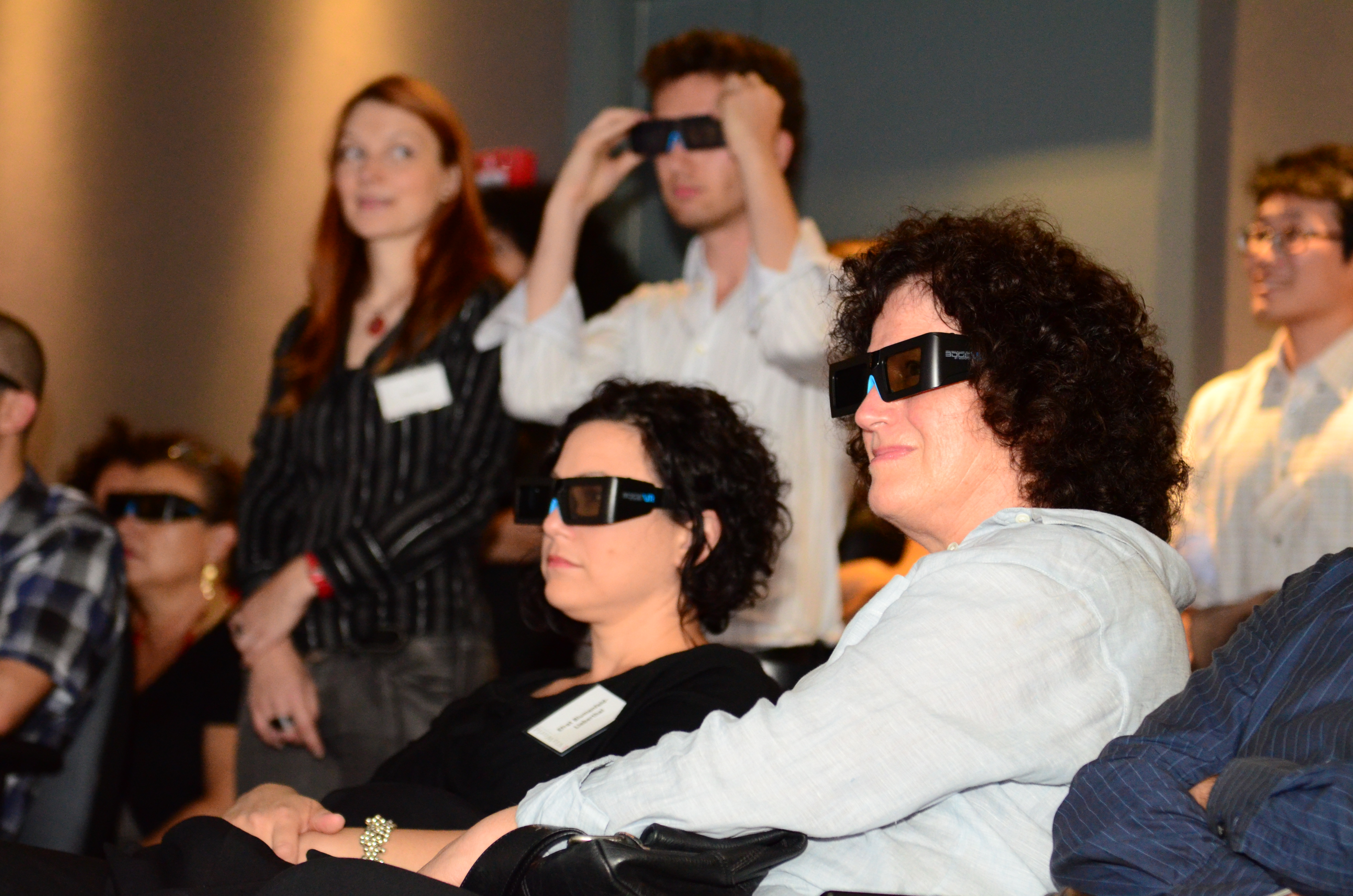
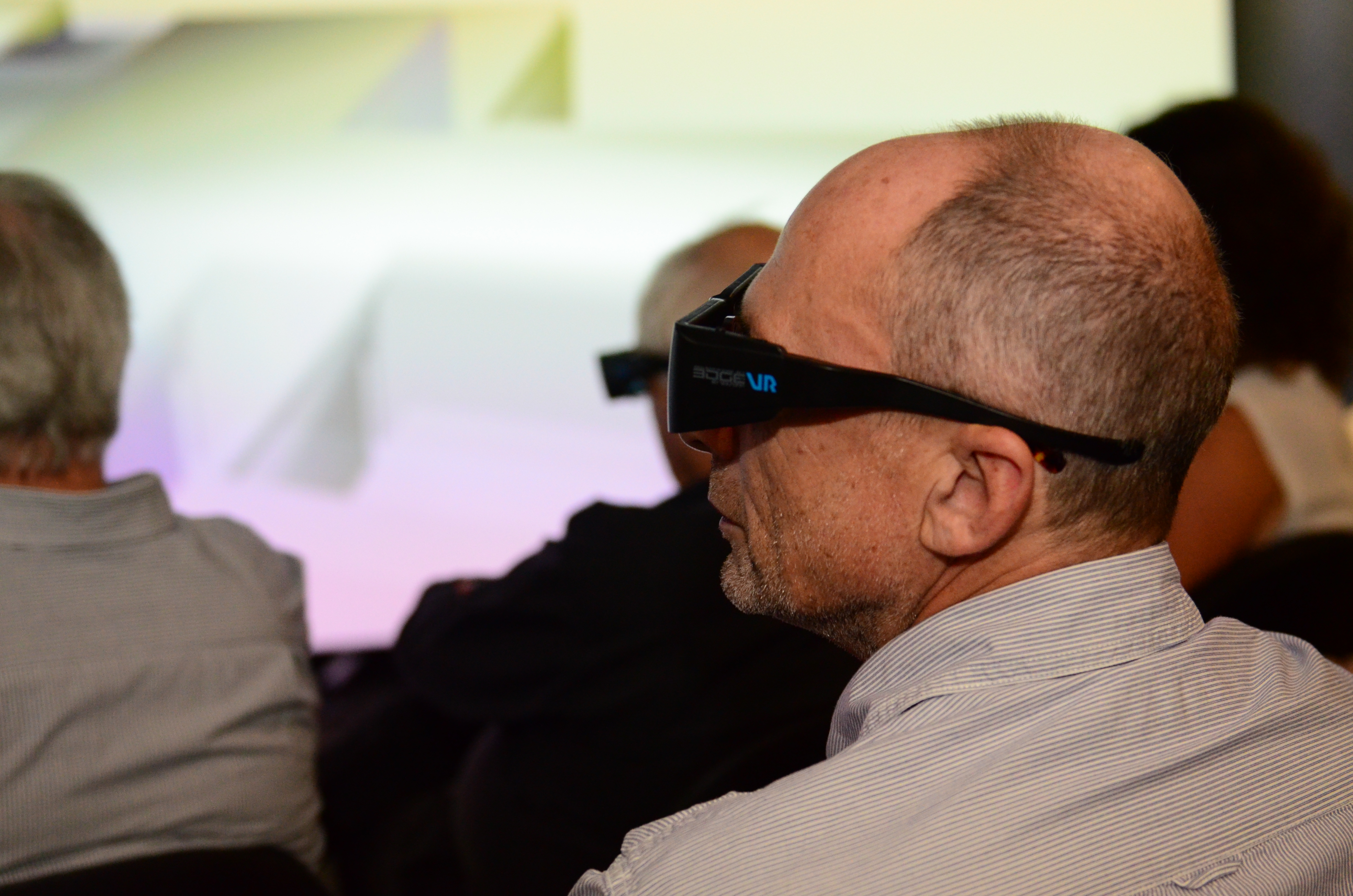
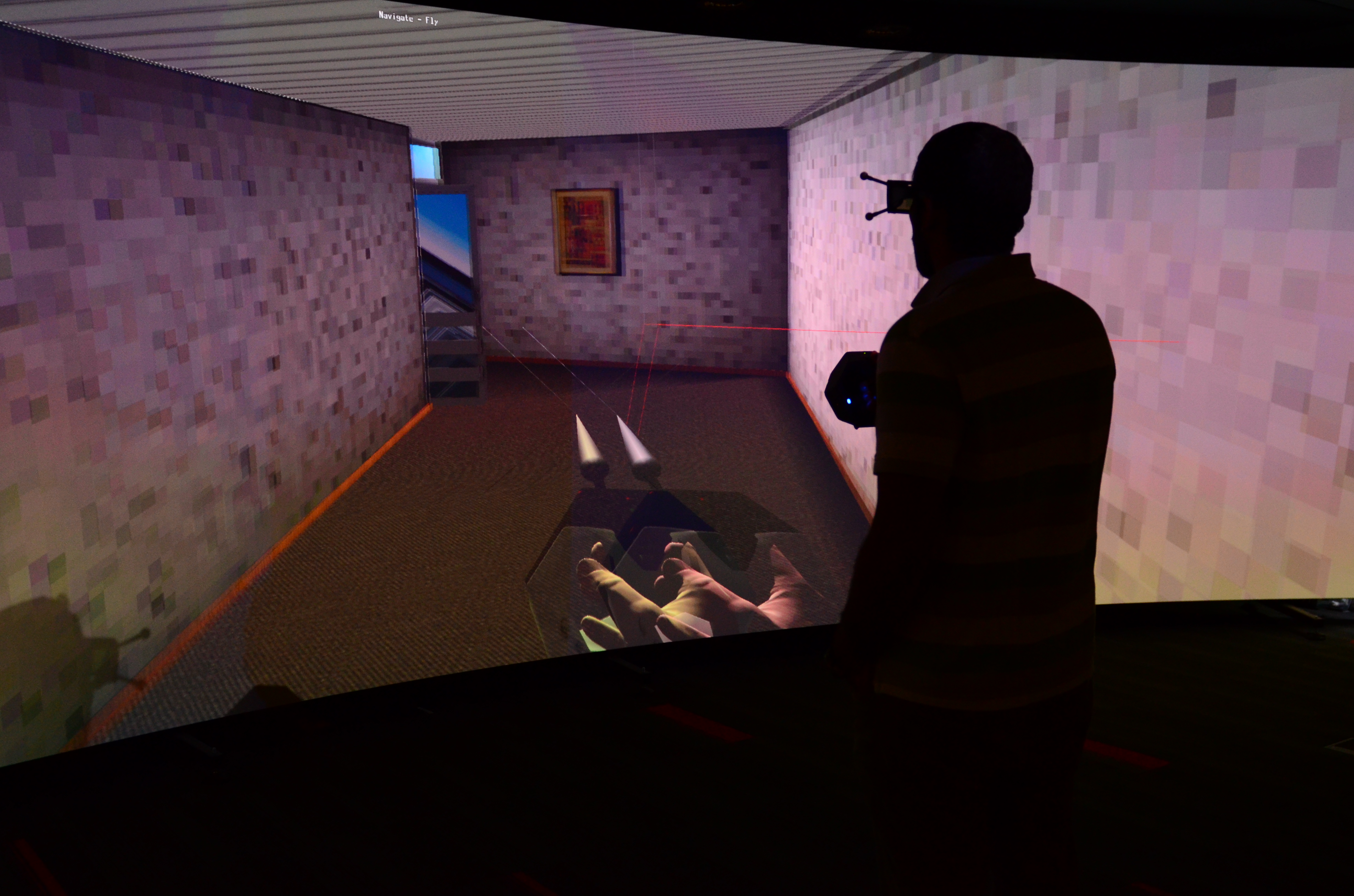
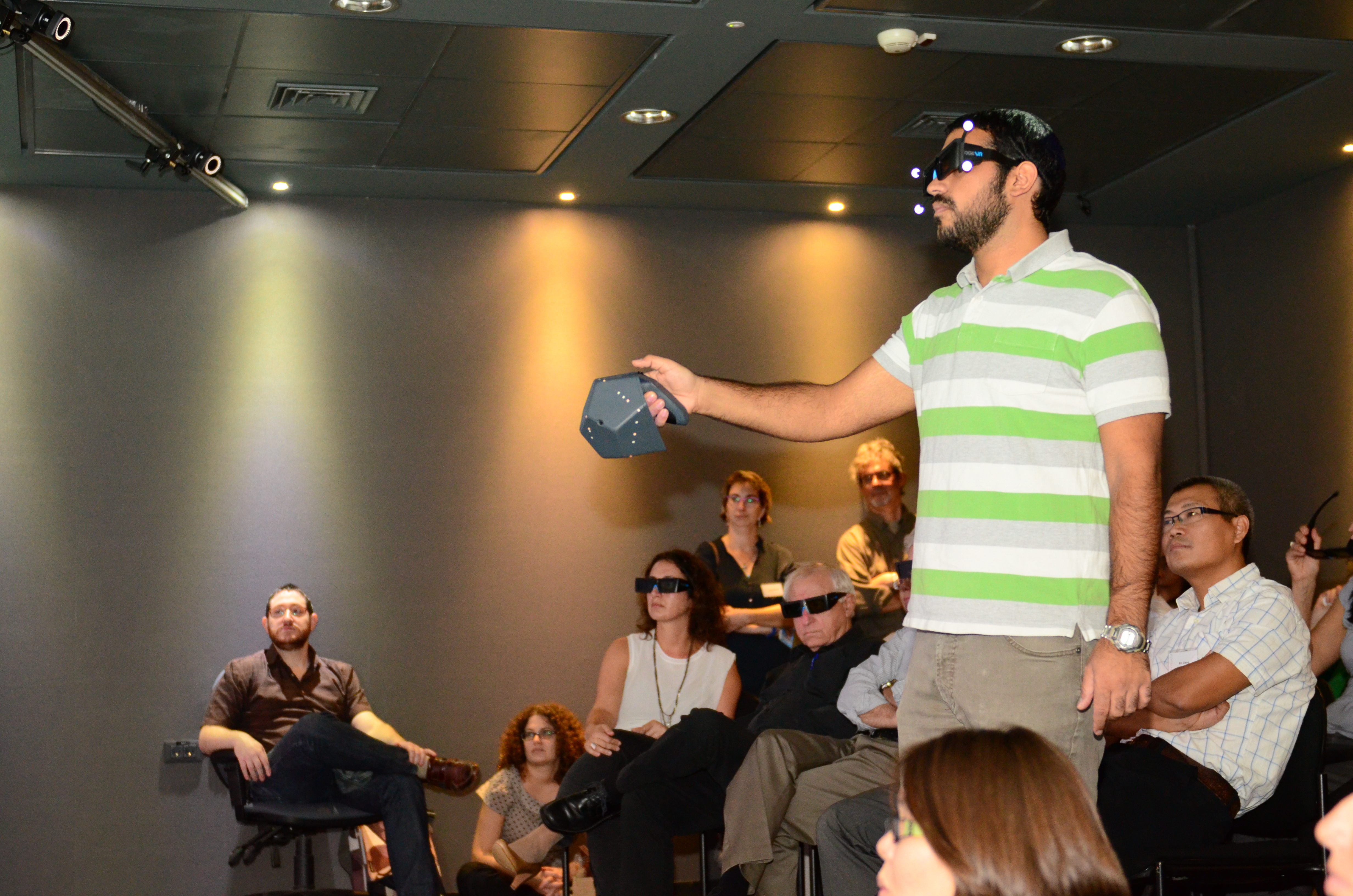
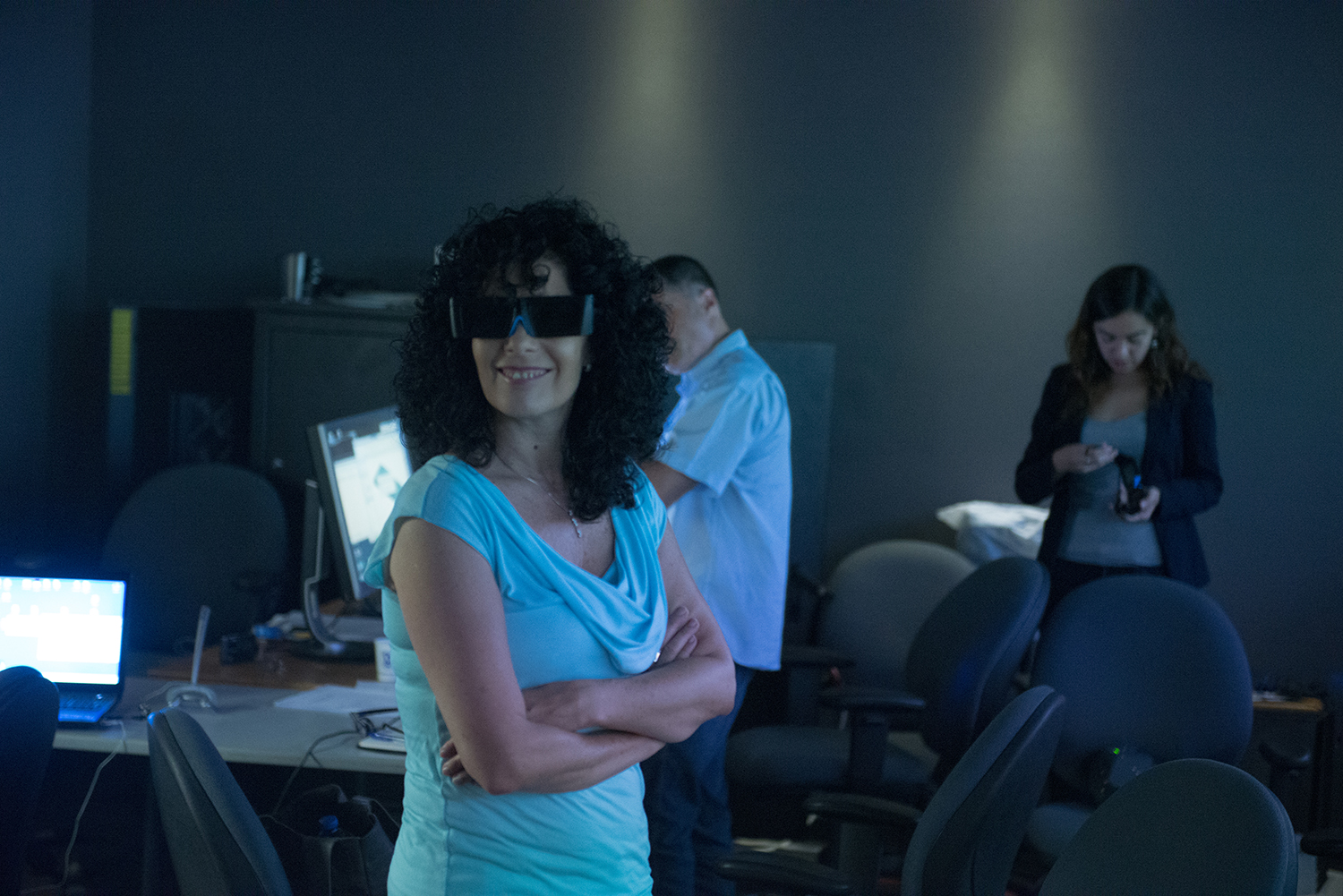
ויזלאב יכול ליצור את החוויה התלת מימדית עד ל20 משתתפים בו זמנית. מצלמות המעבדה עוקבות אחר משתמש אחד אשר יכול לזוז במרחב הוירטואלי או לעבד אובייקטים תלת מימדים ישירות על המסך. בנוסף, המעבדה מצויידת במערכות סאונד, ציוד צילום מקצועי ומשקפי מציאות מדומה אשר זמינים לחברי הפקולטה ולסטודנטים.
מנהלים אקדמיים קודמים
ועדה אקדמית
VizLab was established in Fall, 2013, as part of a collaborative effort of new members of theVizLab users receive the support of trained student technicians who will accompany the user from data preparation to actual use within VizLab.Hours of operationVizLab is staffed on Sundays, Mondays and Thursdays from 9:00 to 15:30, or can be scheduled by appointment.CostUse of the VizLab is free to Faculty staff and students. Other users are welcome for a small fee.
To schedule an appointment to use VizLab or for a demonstration (for no charge), please contact lab manager Prof. Dafna Fisher-Gewirtzman
How to create 3D model for navigation
Former Academic Director
Academic committee
This course will teach the applications of online, Multi-User Virtual Environments (MUVEs) to architectural and landscape architecture students’ design evaluation. MUVEs are virtual (computer and network-based) three-dimensional, immersive environments, much like video games such as World of Warcraft and Second Life. MUVEs allow end-users to experience the designed environments through avatars—virtual representations of human beings—which they can control interactively in real time. The Viz-Lab will display the presence and activities of users in real scale, and thus possibly promotes evaluation and communication amongst students. By populating the design with simulated, animated human beings, users can “walk” through the design and “test” the design through bodily actions, be aware of the presence of others, and share the same spatial experience synchronously with them. The 3D stereoscopic immersion of the Viz-Lab represents a depth of space, and thus it can help students observe users’ behaviors in buildings more precisely. |
VizLab users receive the support of trained student technicians who will accompany the user from data preparation to actual use within VizLab.Hours of operationVizLab is staffed on Sundays, Mondays and Thursdays from 9:00 to 16:00, or can be scheduled by appointment.CostUse of the VizLab is free to Faculty staff and students. Other users are welcome for a small fee:
To schedule an appointment to use VizLab or for a demonstration (for no charge), please contact lab manager Meirav Aharon.
The VizLab is available for users throughout the Technion and beyond. As noted in our multiple projects, the lab serves a broad diversity of uses including:
VizLab users receive the support of trained student technicians who will accompany the user from data preparation to actual use within VizLab.Hours of operationVizLab is staffed on Sundays, Mondays and Thursdays from 9:00 to 15:30, or can be scheduled by appointment.CostUse of the VizLab is free to Faculty staff and students. Other users are welcome for a small fee.
To schedule an appointment to use VizLab or for a demonstration (for no charge), please contact lab manager Prof. Dafna Fisher-Gewirtzman
.
Former Academic Director
Academic committee
Gila Cohen
Role: Research Assitant
Email: gila@mytechnion.email
Phone: 11111
[/jcolumns]
[jcolumns model=”1,3″]
![]()
[jcol/]
Moshe Cohen
Role: Research Assitant
Email: yosi@mytechnion.email
Phone: 222222
[/jcolumns]
|
|
Visuospatial search in urban environment simulated by random walks
|
|
|
|
Perception of density by pedestrians on urban paths: an experiment in virtual reality
|
|
|
|
Human behavior simulation in architectural design projects: An observational study in an academic course
|
|
|
|
CAN 3D VISIBILITY CALCULATIONS ALONG A PATH PREDICT THE PERCEIVED DENSITY OF PARTICIPANTS IMMERSED IN A VIRTUAL REALITY ENVIRONMENT?Dafna Fisher-Gewirtzman |
|
|
|
Why Immersive? Using an Immersive Virtual Environment in Architectural EducationHadas Sopher, Yehuda E. Kalay, Dafna Fisher-Gewirtzman
|
|
|
|
The association between perceived density in minimum apartments and spatial openness index three-dimensional visual analysisDafna Fisher-Gewirtzman
|
|
|
|
Integrating ‘weighted views’ to quantitative 3D visibility analysis as a predictive tool for perception of spaceDafna Fisher-Gewirtzman |
|
|
|
To go where no man has gone before: Virtual reality in architecture, landscape architecture and environmental planningMichelle .E.Portman, A.Natapov, D.Fisher-Gewirtzman
|
|
|
|
Visibility of urban activities and pedestrian routes: An experiment in a virtual environmentEfrat Eizenberg, Daniel E. Orenstein, Hagit Zimroni
|
|
|
|
Visualization for planning and management of oceans and coasts
|
|
|
|
Back to the (Visualization) Laboratory – Using Focus
|
|
|
|
Affective response to architecture – investigating human reaction to spaces with different geometry:Avishag Shemesh, Ronen Talmon, Ofer Karp, Idan Amir, Moshe Bar & Yasha Jacob Grobman
Abstract: A multidisciplinary research was carried out to reach an improved understanding of the connection between the geometry of space and human emotions. The research develops a framework and methodology to empirically examine and measure human reaction to various types of architectural space geometries. It involves two stages of investigations in which participants experience four spaces characterized by different geometries. Their reaction to the spaces was investigated by means of both qualitative and quantitative methods, which involved questionnaires in the first experiment and advanced sensors and data analysis in a second experiment. The experiments, which employ new virtual reality, electroencephalogram and data analysis methods, confirm the developed methodology. In the first stage of the investigation, participants showed different types of responses and preferences towards spaces. Results of the second stage’s experiment showed a difference in our mental reaction to different geometries of space. |
|
|
|
The immersive visualization theater: A new tool for ecosystem assessment and landscape planning:Daniel E. Orenstein, Hagit Zimroni, Efrat Eizenberg |
research grant
research grant
MSc Thesis by Michal Gath Morad, Advisers: Yehuda E. Kalay, Pnina Plaut
The project is part of a MSc thesis by Michal Gath Morad. The thesis project provides an empirical exploration of “smart cities” from a human, technological and spatial perspective. The main question which underlies the research is how can we tell if Information and Communication Technologies (ICT) could make cities “smarter”? And if yes, what would be the tradeoffs of such urban “smartness”? Unlike past technologies used by cities as part of a strategic plan, carefully devised by planners and experts, today’s most powerful technology —ICT—is used and owned by everyone: planners and citizens alike. A multitude of applications at citizens’ disposal help them process information in real time and empowers them with new decision-making capabilities, which enable them to act according to their individual goals as they gain what I term ”artificial spatial intelligence”. Current research in this field fails to account for the human and spatial factor in “smart cities” and evaluation tools that can help planners evaluate and design truly “smart cities” are limited. To mitigate this gap, a virtual smart city simulation is developed, in which objects (obstacles, people, cyclists, buses, Points of Interest) locations and status is being recorded in real time. The information feed is then processed and delivered to pedestrians, filtered by their personal preferences. To test the effect of this so called “smart city” on pedestrian behavior, the visualisation lab is used to conduct experiments in which real human pedestrians interact with the smart city simulation in a virtual reality setting. The experiment results are still being processed but it’s evident that ICT played a significant role in pedestrian’s decision making process, which in turn transformed the way they walked and “used” the city. The ability to simulate individual pedestrians behavior and how it is affected by enhanced spatial awareness facilitated by ICT, could result in new understanding of how a city is used, making visible less predictable use patterns and contribute to the design of truly smart and livable cities.
Dr. Hagit Zimroni, Dr. Daniel Orenstein, Dr. Efrat Eizenberg.
We utilize VizLab to study stakeholder perceptions of landscapes and their associated cultural ecosystem services in Israel’s Carmel Forest. Visualization has become a ubiquitous method in land use planning to actively engage stakeholders in decision making. In our research, funded by the Israel Ministry of Environmental Protection, the subject (stakeholder) is exposed to a diversity of actual and hypothetical landscapes where they can experience and evaluate multiple land use alternatives. We project various high definition photographs reflecting current status of the forest and future scenarios of forest management (e.g. density and species of trees, presence/absence of buffer zones) as a trigger for focused group discussions regarding aesthetic and ecological issues in the forest.
Contact: Dr. Hagit Zimroni.
Dr. Michelle Portman, Dr. Daniel Orenstein, Dr. Tally Katz-Gerro (Haifa University), and Mr. Semion Polinov.
We are developing methodologies for identifying, quantifying and analyzing ecosystem services (ES) on land and sea. The case study for our multidisciplinary assessment is a land-sea transect starting on Mt. Carmel and continuing and including the Mediterranean Sea (to the outer limit of Israel’s territorial sea, c. 22 km from the shoreline). Our methodology includes: 1) selection of indicators for valuing ecological, economic and social aspects of ES, 2) developing a GIS-based method for defining the spatial dimensions of ES, and 3) applying the method to policy-making for spatial planning and natural resource management. The Vizlab helps us to perform quality control of services indicators (e.g. visibility of landscape from given geographic points) and to get a better view and understanding of the complexity of the different landscape units as they change spatially and temporally. By using 3D imaging we can improve our understanding about the correlation between visibility from a given point and its aesthetic value as well as view the extent of the transect as a continuous unit from multiple perspective (e.g., flyover view of bathymetry).
Contact: Dr. Michelle Portman.
Dr. Asya Natapov, Prof. Daniel Czamanski, Dr. Dafna Fisher-Gewirtzman.
This project is part of the PhD research of Asya Natapov. It utilizes VizLab to investigate human navigation in urban environment. In particular, we are interested in the interaction of urban functional structure and human cognitive capabilities, such as vision. We explore the distribution of one particular urban function – cafés, coffee shops, restaurants and other food and drink facilities and investigate their visibility within urban setting of the historical district of Tel Aviv-Yafo, called Lev Hair (City Center). Immersive virtual reality platform of the VizLab allows performing navigational tasks in more controlled way, than in real urban environments. Thus, we construct a three dimensional model of the case study and carry out walk-through experiments in order to investigate human navigational strategies, route choices and decision making processes. During the experiments participants’ trajectories and destination points are tracked. This information is expected to give insights about human perception and navigation in urban space and will be compared with spatial analysis data developed on the previous stages of the research.
Contact: Asya Natapov.
Dr. Dafna Fisher-Gewirtzman.
The objective of this research was to develop an integrated analysis and modeling for environmental systems referring to interior space layout and functionality: integrating advanced Spatial Openness Index within realistic geovisualized Geographical Information (GIS) environment and assessment against subjective residents evaluation. In this stage of the research two attempts to develop an elaborated 3D visibility analysis were made. The next step for both models development is considering attributes of the environments, that is to say, the quality of visible space in addition to quantity; establishing an elaborated 3D visibility analysis with a GIS environment. A wide-scale assessment to the voxel based 3D visual analysis have been completed. The results have shown very strong tendency and high correlation between perceived density and the measured volume of space.
Contact: Dafna Fisher-Gewirtzman.
Graduate student Avishag Shemesh, Dr. Yasha (Jacob) Grobman, Professor Moshe Bar (Bar Ilan University).
This research will aspire to develop and evaluate research methods and tools that examine the connection between geometry of space, visual perception and emotions. Using the Visualization lab in the architecture faculty, which contains 3-D visualization capacity and motion sensors, Participants will be experiencing an inner virtual space, while their brain response and physiological response will be observed. This observation will be possible through the use of advanced handled devices such as EEG and GSR, which will be attached to the participant as he moves freely through the virtual space.
Contact: Avishag Shemesh.
[pb_slideshow group=”1″]
אירועים |
18.2.18 |
פרופ ‘מנואל טרכטנברג – בית הספר לכלכלה ע”ש איתן ברגלס |
4.2.18 |
פרופ ‘יואל ל’ זוסמן – מכון ויצמן למדע |
|
1.2.18 |
ד”ר ענת בן דוד – המכון לאוניברסיטה הפתוחה לניתוח מדיניות |
|
Show more… |